Product Description:
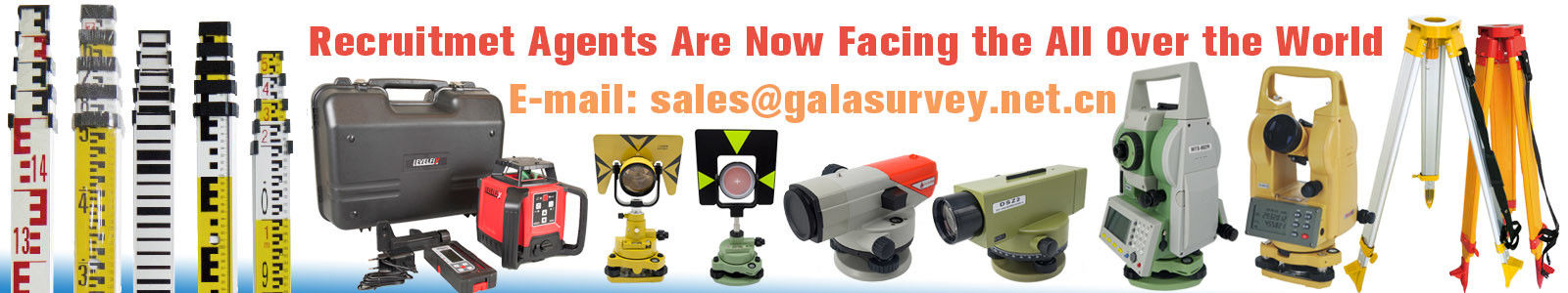
The MATO Total Station is a state-of-the-art surveying instrument designed to meet the demands of modern construction, engineering, and geospatial projects. Combining precision, durability, and advanced technology, this reflectorless total station offers unparalleled performance for professionals who require accurate measurements and reliable data collection in the field.
One of the standout features of the MATO Total Station is its impressive none prism distance capability of up to 500 meters. This reflectorless measurement functionality allows users to capture precise distance readings without the need for a physical prism target, greatly enhancing efficiency and safety, especially in challenging or hazardous environments. Whether you are measuring hard-to-reach points or conducting topographic surveys, the MATO Total Station delivers consistent and accurate results.
Durability is a key consideration for any surveying equipment, and the MATO Total Station excels in this regard with its robust IP66-rated dust and water resistance. This high level of protection ensures that the instrument can withstand harsh environmental conditions such as heavy rain, dust storms, and extreme temperatures. Surveyors can rely on the MATO Total Station to perform flawlessly on construction sites, mining operations, and outdoor projects where exposure to the elements is unavoidable.
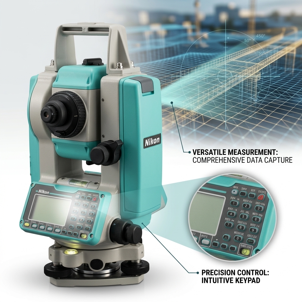
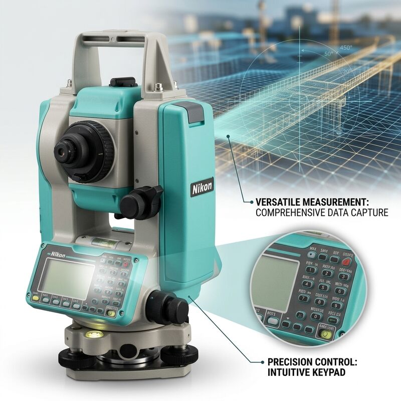
Equipped with a convenient USB port, the MATO Total Station facilitates seamless data transfer and connectivity. Users can easily upload and download project files, update firmware, and back up measurement data without the hassle of proprietary cables or complex software. This feature enhances workflow efficiency and allows for quick integration with other digital tools and software platforms used in surveying and mapping tasks.
At the core of the MATO Total Station lies a sophisticated Real-time Operating System (RTOS) that ensures smooth and reliable operation. The RTOS optimizes the instrument’s performance by managing resources efficiently, providing real-time feedback, and minimizing system delays. This results in faster data processing and improved user experience, enabling surveyors to complete their tasks more effectively and with greater confidence.
In addition to its inherent capabilities, the MATO Total Station is fully compatible with GNSS receivers, allowing for hybrid positioning solutions that combine the strengths of total stations and satellite-based navigation. This integration is particularly valuable for large-scale projects requiring high-precision geospatial data and seamless coordination between different surveying technologies. By leveraging GNSS connectivity, professionals can enhance accuracy, reduce survey time, and improve overall project outcomes.
The MATO Total Station stands as a competitive alternative to well-known brands such as the Leica total station, offering comparable accuracy and advanced features at a more accessible price point. Its user-friendly interface, rugged construction, and versatile functionality make it an ideal choice for surveyors, engineers, and geospatial professionals seeking a reliable and efficient instrument for their measurement needs.
In summary, the MATO Total Station combines cutting-edge reflectorless total station technology with robust design and intelligent software to deliver exceptional surveying performance. Its 500-meter none prism distance capability, IP66 dust and water resistance, USB connectivity, and real-time operating system collectively provide a comprehensive solution for precise and efficient field measurements. Whether integrated with GNSS receivers or used as a standalone device, the MATO Total Station is engineered to support demanding fieldwork and deliver trustworthy results in a wide range of applications.
Features:
-
Product Name: Total Station
-
Includes USB Port for easy data transfer
-
Minimum Readout Options: 1", 5", 10"
-
HS Code: 9015800090
-
Data Format: ASCII for compatibility
-
Measurement Methods: Absolute, Continuous, Diametrical
-
Compatible with GNSS receiver integration
-
Functions as a Digital level for precise leveling
-
Part of the reliable Sokkia total station series
Technical Parameters:
|
Coarse
|
0.6s (initial 1.3s)
|
|
Trademark
|
MATO
|
|
Memory Type
|
Internal Flash Memory And External SD Card
|
|
Size
|
5.0″ Capacitive Multi-Touch
|
|
Memory
|
Memory 1G Mass Data Storage
|
|
Dust and Water Resistance
|
IP66 Rated
|
|
Minimum Readout
|
1"/5"/10"
|
|
USB Port
|
With USB Port
|
|
HS Code
|
9015800090
|
|
Data Format
|
ASCII
|
Applications:
The Leica TS03 Total Station is a versatile and high-precision surveying instrument designed to meet the demands of various application occasions and scenarios in the fields of construction, engineering, and land surveying. With its CE certification and robust IP66 rated dust and water resistance, the TS03 ensures reliable performance even in harsh environmental conditions, making it ideal for outdoor projects where durability is crucial.
One of the key application occasions for the Leica TS03 is in GPS RTK integrated surveying tasks, where precise coordinate measurement is essential. Surveyors can combine the TS03 with GPS RTK technology to achieve centimeter-level accuracy, streamlining workflows in large-scale infrastructure projects such as highways, bridges, and urban development. Its minimum readout capability of 1", 5", and 10" allows users to select the appropriate precision level according to project requirements, ensuring flexibility and efficiency.
The TS03 stands out when compared to other professional instruments such as Sokkia total station and Topcon total station models, offering competitive features at a price point of 6000 USD. Its trademark MATO and Leica branding guarantee quality and innovation. With a none prism distance of up to 500 meters, the TS03 enables surveyors to conduct long-range measurements without the need for a prism, enhancing productivity in challenging terrain or restricted access sites.
In construction site layout, boundary surveying, topographic mapping, and monitoring tasks, the Leica TS03 proves indispensable. Its internal flash memory combined with external SD card support allows for ample data storage and easy transfer, facilitating seamless integration with modern data management systems. The packaging details, including a carton and plastic box, ensure secure transit and protection, while the supply ability of 1000 pieces per month guarantees availability for large project deployments.
With a minimum order quantity of just 1 PC and a swift delivery time of 2-3 days, customers benefit from quick procurement and deployment. Payment terms are flexible via TT, streamlining the purchasing process. Whether you are upgrading from a Sokkia total station or Topcon total station, or integrating GPS RTK into your surveying arsenal, the Leica TS03 Total Station offers a reliable, precise, and durable solution for all your surveying needs.
Customization:
Leica TS03 Total Station offers exceptional precision and reliability for surveying professionals. Featuring automatic compensator with ±3 arc minutes range for auto leveling, this top-tier instrument ensures accurate measurements every time.
Certified with CE standards, the Leica TS03 combines advanced technology with robust design, including IP66 rated dust and water resistance, making it suitable for various challenging environments.
With a minimum readout capability of 1"/5"/10" and a none prism distance of 500 meters, it delivers outstanding performance comparable to other industry leaders such as Topcon total station, Digital level, and GNSS receiver systems.
The device is equipped with 1G mass data storage memory, allowing efficient data management and ease of use in the field.
Each unit is carefully packaged in a carton plus plastic box to ensure safe delivery. The minimum order quantity is 1 PC, priced at 6000 USD, with a delivery time of 2-3 days and payment terms of TT.
Leica guarantees a supply ability of 1000 pieces per month, supporting large-scale projects and continuous demand.
Customize your surveying solutions with Leica TS03 Total Station and experience superior accuracy and durability, ideal for professionals seeking alternatives to Topcon total station, Digital level, and GNSS receiver equipment.
Support and Services:
Our Total Station product is supported by a dedicated team of technical experts committed to providing comprehensive assistance and services. We offer detailed product documentation, including user manuals and quick start guides, to help you get the most out of your equipment.
Technical support is available to assist with installation, calibration, operation, and troubleshooting to ensure optimal performance of your Total Station. Our skilled technicians are ready to provide remote support and guidance to resolve any issues you may encounter.
We also provide regular software updates and firmware upgrades to enhance functionality and maintain compatibility with the latest technologies. Training services are available to help users understand the full capabilities of the Total Station and improve operational efficiency.
For maintenance, we recommend periodic calibration and servicing by authorized professionals to ensure accuracy and longevity of your instrument. Replacement parts and accessories are readily available to keep your Total Station operating at peak performance.
Our commitment is to deliver reliable and responsive technical support and services that meet the needs of professionals in surveying, construction, and engineering.
FAQ:
Q1: What is the brand and model of this Total Station?
A1: The Total Station is a Leica brand, model number TS03.
Q2: Is the Leica TS03 Total Station certified?
A2: Yes, the Leica TS03 Total Station is CE certified.
Q3: What is the minimum order quantity for the Leica TS03?
A3: The minimum order quantity is 1 piece.
Q4: How much does one unit of the Leica TS03 Total Station cost?
A4: The price for one unit is 6000 USD.
Q5: What are the packaging details and delivery time for this product?
A5: The product is packaged in a carton and plastic box, and the delivery time is typically 2-3 days.
Q6: What payment terms are accepted for purchasing the Leica TS03?
A6: Payment is accepted via TT (Telegraphic Transfer).
Q7: What is the supply ability of the Leica TS03 Total Station?
A7: The supply ability is 1000 pieces per month.

 Pesan Anda harus antara 20-3.000 karakter!